![]()
破解說明:
CT Eng
JJFZW-J8W8P-5CUGW-CX3UY-4ZJYQ
雙擊cyklotrasy-en註冊表項即可破解!
軟體簡介:
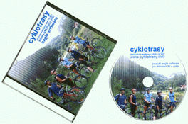
Cyklotrasy v2.19 可幫助自行車自助旅行者規劃旅遊路線的軟體 英文正式版
官方網站:http://cyklotrasy.info/en/
軟體簡介:一款可幫助自行車自助旅行者規劃旅遊路線的軟體。
let me introduce you our software Cyklotrasy (cycling
trails). Imagine software, where you can set (from map or
list) your starting point, some transit places and the
final point of your journey. You can choose searching
preferences, e.g. type of surface, and let the software
plan your own route. The software will get you a lot of
useful information e.g. profile of your trail, map,
itinerary and statistic data.
Cyklotrasy gives you a lot of information, e.g. altitude,
latitude, longitude, photos, texts, lengths of distances,
nubers of roads, numbers of bike-ways, types of surfaces,
hiking and bike marking. You can observe route total
length, superelevation, rise and fall. There are also
prepared routes, where you can find difficulty and type of
recommended bike. You can print profile, map, itinerary and
statistic. Visual apperance of profile and map can be
adjusted with preferences. You can export profile and map
into picture, web site or GPS format. User can make a diary
of his/her trips, including a lot of data. Up to this date
there are 98 maps for Cyklotrasy. Maps are developed by
administrators who update maps at least ones a year.